Geotech & Engineering

Examples of applications in mining, groundwater & engineering.

To improve the way subsurface data is measured, collected and transformed into knowledge.

  • Mineral detection and indication of mineralisation zone
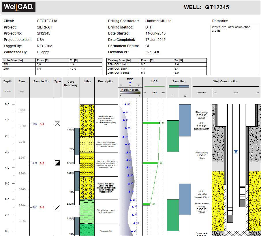
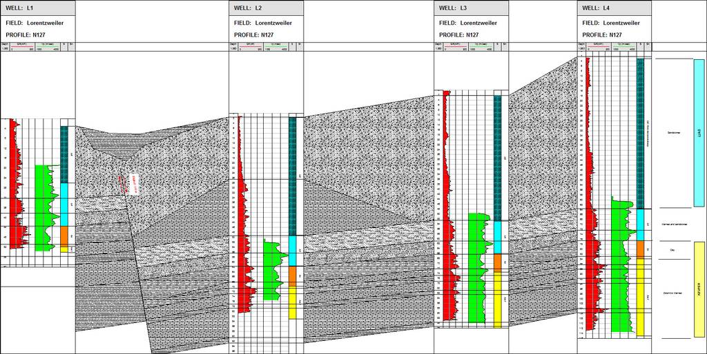
  • Lithology identification
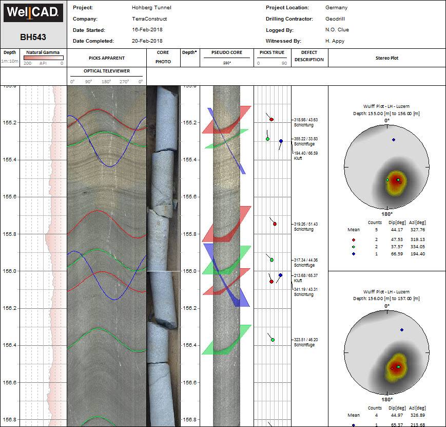
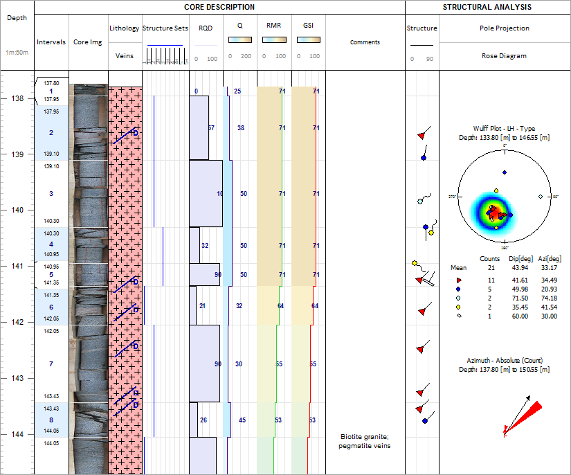
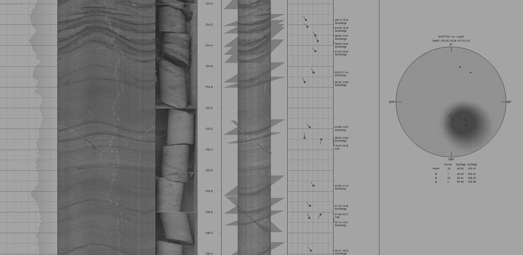
  • Fracture identification and orientation
  • Detection of weathered and fractured zones
  • Core orientation
  • Stratigraphy and bed thickness
  • Permeable zones and porosity
  • Borehole shape, volume, integrity and orientation
  • Coal quality
  • Density
  • Local stress
  • Rock strength and elastic parameters
  • Location of aquifers / aquitards
  • Water quality and contamination
  • Fluid flow measurements
  • Geological structure analysis from optical televiewer and core box images.
  • Engineering report with lithology profile from core data, geotechnical data, and well completion diagram.
  • Geotechnical core description.
  • Multi-well cross-section from a tunnel construction project.
CLOSE
  • Geological structure analysis from optical televiewer and core box images.
  • Engineering report with lithology profile from core data, geotechnical data, and well completion diagram.
  • Geotechnical core description.
  • Multi-well cross-section from a tunnel construction project.

1 of 20