The Multi-Well module for WellCAD is an intuitive and easy-to-use tool for correlating multiple wells.
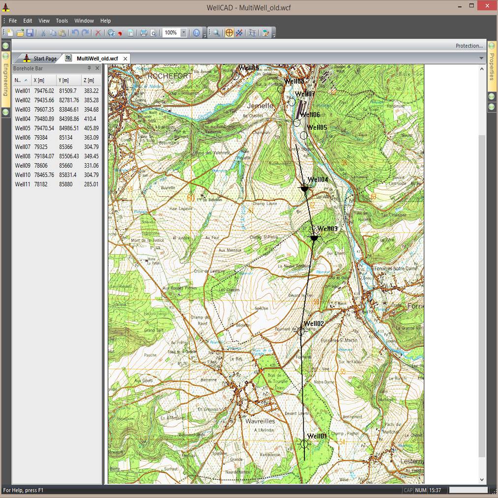
- A zoomable map acts as the graphical data management interface handling well location, well status, and profile orientations.
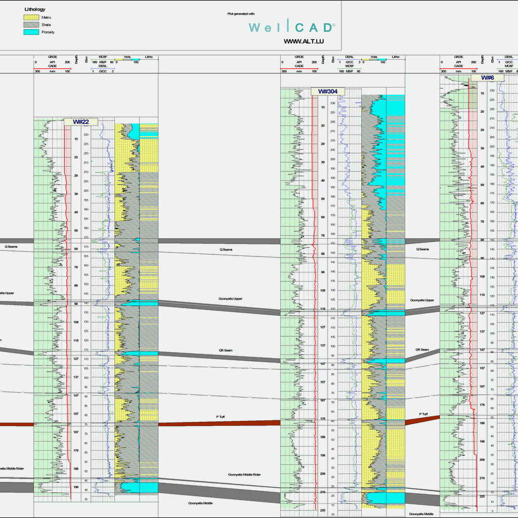
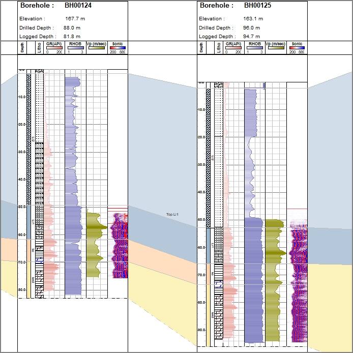
- An orthographic view shows the projection of all borehole data on user-defined multi-segment profiles with custom orientation.
- Supports interactive fitting of surfaces and volumes as well as automated generation of surfaces from formation/surface markers.
- A projection view displays the wellbore trajectory in conjunction with surfaces and volumes.
- The mobile Field Document architecture provides a comprehensive data repository without the need for a database.
- Seamlessly integrated into WellCAD, the multi-well module allows access to field as well as borehole data.