The module provides various methods to compute wellbore trajectory coordinates from survey data and generate 2D and 3D presentations of the wellbore path.
- Computation of wellbore azimuth and inclination (tilt) from accelerometer and magnetometer components.
- Classic and balanced tangential, radius, and minimum radius of curvature algorithms to derive trajectory coordinates.
- Easy computation of TVD, TVDSS, Elevation and alternative depth references.
- Closure, drift (closure distance), and DLS calculations.
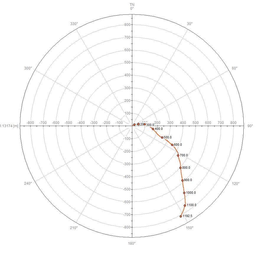
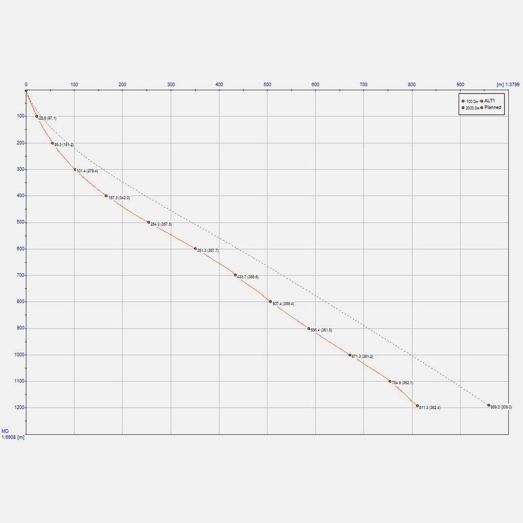
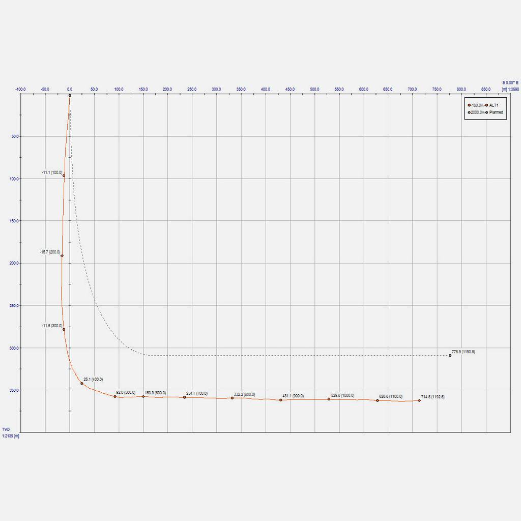
- Classic 2D top view (bull’s eye), vertical profile projection and drift view diagrams.
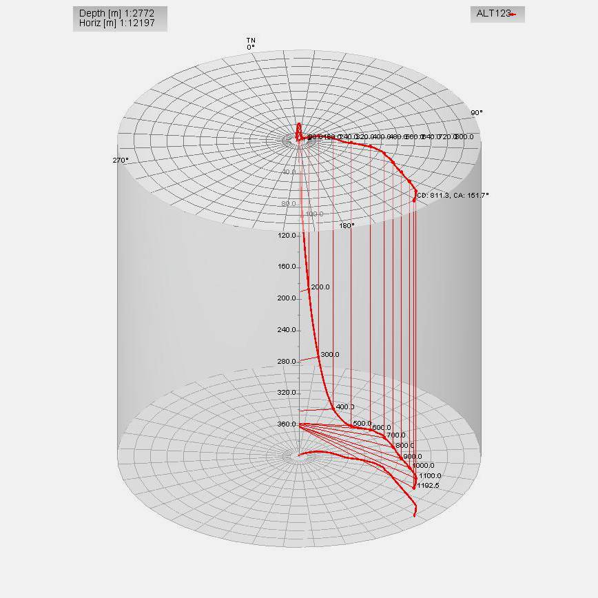
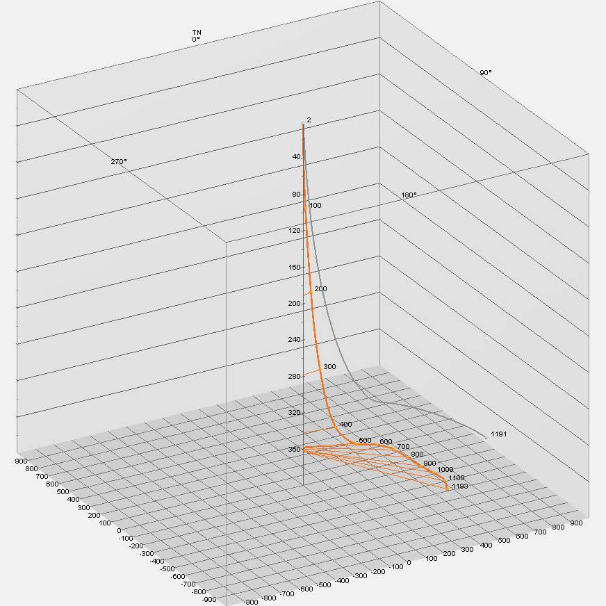
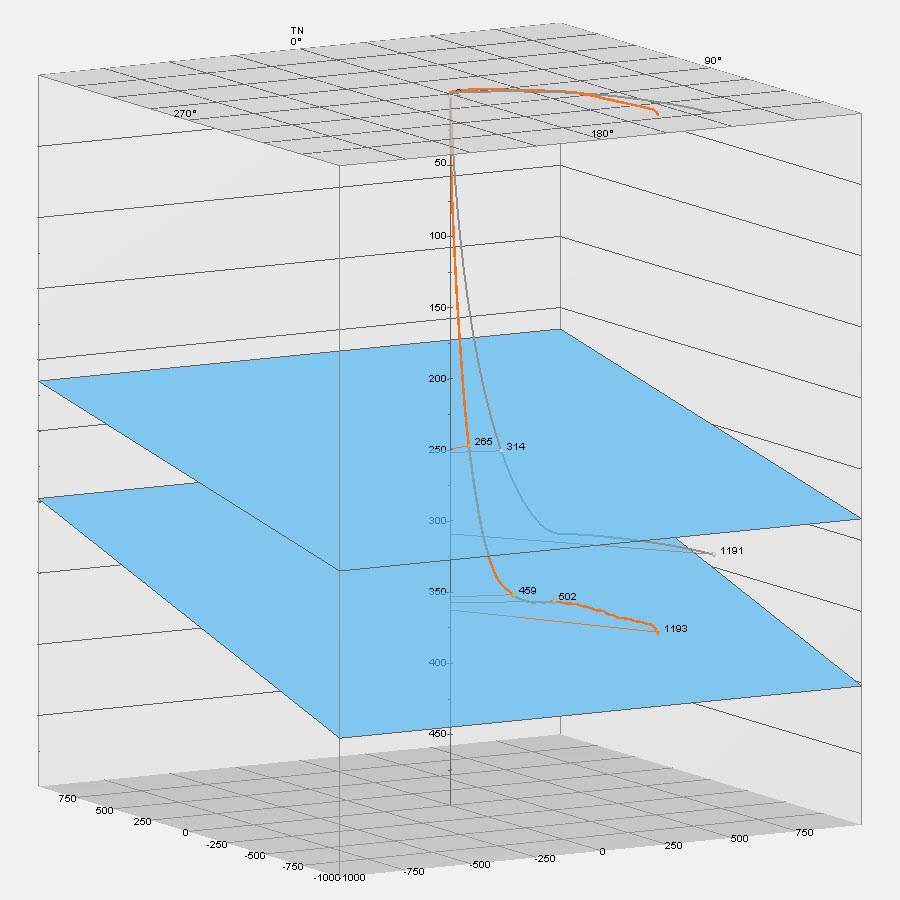
- 3D Northing/Easting (cubic) and Drift/Closure (cylindrical) diagrams.
- Multipath overlay (e.g., planned and drilled).
- Target layer intersection.